Position paper 30/2023 by C. Agnoletti, C. Ferretti, L. Ghezzi , M. L. Maitino, R. Paniccià, V. Patacchini, L. Piccini, L. Ravagli and N. Sciclone
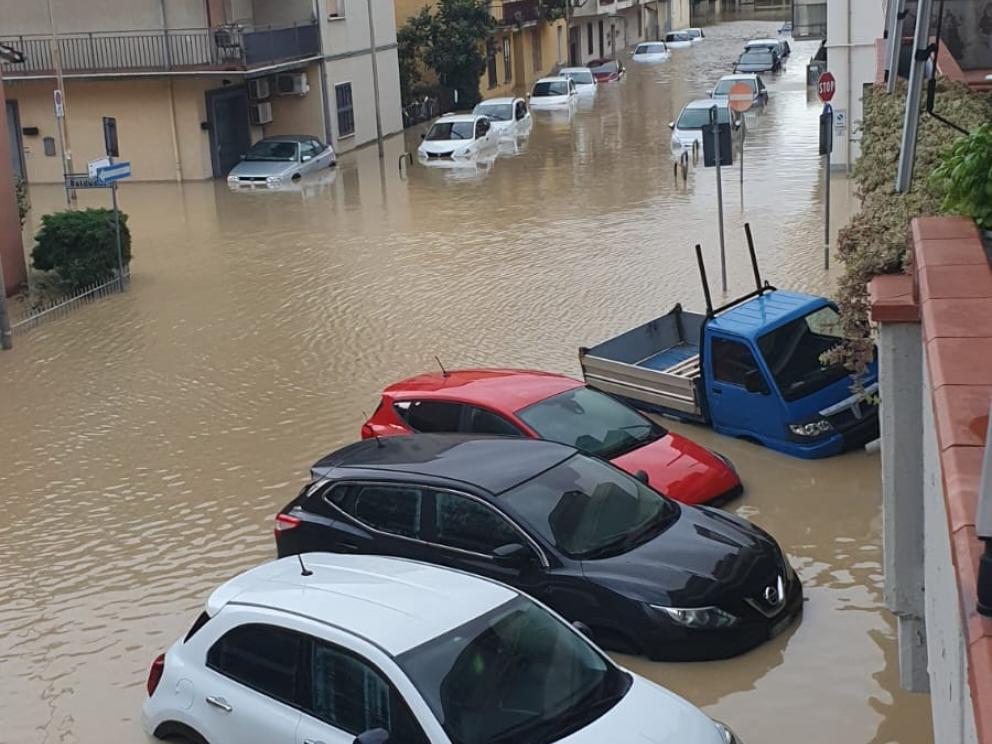
This note presents the objectives, methodology, and results of a procedure for estimating the costs incurred by households and businesses for flooding that occurred on or after Nov. 2, 2023, in Tuscany.
The quantification of damages illustrated here is not the result of a census: neither statistical nor administrative. A census of this nature would require, in the first case, the necessary time of a survey procedure (statistical census) to which, in the second case, should be added a simultaneous and/or subsequent verification of the economic losses suffered (administrative census).
The need for rapid quantification of the damage suffered is here fulfilled through an estimate derived from statistical sources, of various kinds, whose values have been appropriately reproportioned on the territorial scale affected by the weather event. All with the aim of obtaining, in the first instance, the total value of flow and stock magnitudes potentially exposed to economic loss.
On this aggregate, in the variegated cases subsequently described, a damage size scenario, among many possible ones, was applied, which was tested and constructed with the help of information gathered through an interlocution, guided through a quick questionnaire, with some trade associations.
In the case of businesses, through Input/Output modeling available from IRPET, in addition to direct damage, indirect and induced damage was also calculated. The former involves sectors and firms not directly affected by the flood, but which are in commercial exchange relationships (for purchase, for example, of intermediate goods) with the firms that suffered the losses. Induced damage is that potentially related to a contraction in consumption due to lower incomes.
The methodology adopted here has the advantage of being replicable at any spatial scale-with appropriate adjustments in the use of data-and over time.